01
Live fleet visibility
Know where every vehicle is, what it is doing, and what needs attention now.

Aerolive gives fleet and field teams one live operating picture—from vehicle movement and route progress to costs, safety, and service performance.

Demo Operations Dashboard
Sample data shown for product demonstration
Active
1,284
On time
98.6%
Alerts
12
Route health
Demo Fleet · North district
Priority activity
LiveUnit A-204
Assigned · East hub
Unit V-118
Assigned · East hub
Unit T-309
Assigned · East hub
Built for modern fleet operations
One connected platform
Three essential capabilities work together to keep managers, dispatchers, and field teams aligned.
01
Know where every vehicle is, what it is doing, and what needs attention now.
02
Plan practical routes, compare progress, and resolve delays before service is affected.
03
Turn operational activity into clear trends for utilization, cost, and service quality.
Hardware compatibility
Aerolive provides a flexible telematics platform designed to integrate with GPS trackers, vehicle tracking devices, sensors, cameras and IoT hardware from a wide range of manufacturers.












Brand names and trademarks belong to their respective owners and are shown only to indicate device compatibility. Compatibility may vary by device model, firmware and integration requirements.
Core products
Start with the areas that matter today, then expand without adding disconnected tools or duplicate data.
Live locations, status, speed, ignition, and trip context in one view.
Coordinate vehicles, drivers, assignments, costs, and daily exceptions.
Build efficient multi-stop plans and compare planned movement with reality.
Track progress, ETAs, stop outcomes, and proof of completion.
Understand consumption, refills, losses, mileage, and efficiency trends.
Turn driving events and hours into coaching-ready safety insights.
Review live cameras and event clips with vehicle and trip context.
Measure utilization, performance, cost, safety, and service outcomes.
Real-time GPS tracking
A live fleet map connects movement, vehicle state, trip details, and exceptions so dispatchers can respond with confidence.
 Signal from vehicle to platform
42 vehicles online
Sample fleet • Demo data
Unit AL-204
MovingDemo data
Step 1
Vehicle
Trackers and sensors fitted to the vehicle
Step 2
GPS & telematics
Position, speed, ignition and sensor data
Step 3
Live location
Continuous position updates
Step 4
Map & route
Movement placed on the fleet map
Step 5
Fleet control
Alerts, decisions and reports
Route & trip management
Build multi-stop plans, follow actual progress, and surface deviations before they become missed deliveries.
Actual route
Planned / deviation
Trip AR-482
Sample fleet • Demo data
Unit AL-204
MovingDemo data
Sample trip data · demo only
7 / 10
Stops complete
64%
Trip progress
14:32
Next ETA
Fuel monitoring
Monitor levels and consumption continuously, detect refills or sudden drops, and compare efficiency across vehicles and time.
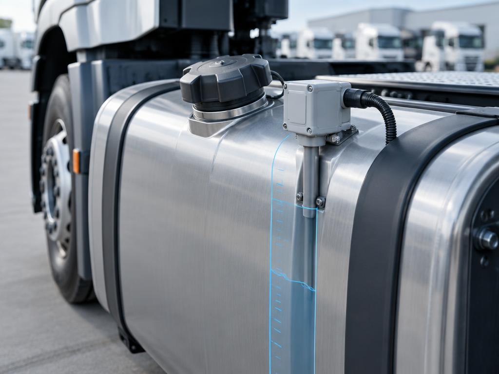
Tank-level sensing
Supported fuel sensors report tank level continuously, so refills and sudden drops become visible events rather than month-end surprises.
Fuel intelligenceDemo data
Sample fleet consumption · 30 days · illustrative values
Current level · AL-204
Efficiency
8.4
km / litre
Driver AL-01
Sample driver profile • Demo data
92
Demo safety score
Speeding
3 events
Harsh braking
1 event
Rapid acceleration
2 events
Excessive idling
38 min
Driver management
Build fair, consistent driver profiles from real road events, working hours, and safety performance.
Video telematics
Connect road and driver cameras with trip data to review incidents quickly, coach fairly, and protect your operation.
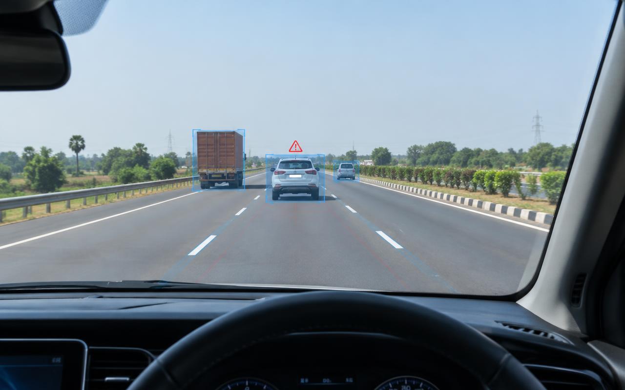
Event timelineDemo
DMS + ADAS
Aerolive combines driver monitoring and road-facing assistance to surface risks when they matter and preserve clear event evidence.
Driver monitoring system
In-cabin risk detection
Advanced driver assistance
Road-facing safety intelligence
Geofencing & smart alerts
Create virtual operating areas and route exceptions to the right team with a focused, configurable alert centre.
North Depot Zone
18 vehicles inside
Demo data
Alert centreDemo data
Sample alerts · 8 require attention
Overspeed
AL-204 · 2 min ago
Route deviation
VN-118 · 6 min ago
Fuel drop
TR-309 · 12 min ago
Maintenance due
AL-086 · Today
Battery disconnect
VN-042 · Yesterday
Driver safety event
TR-217 · Yesterday
Vehicle health
Sample vehicle record · demo data
48,206 km
Odometer
2,884 h
Engine hours
94%
Battery health
Clear
Diagnostics
Trip history & playback
Sample trip · demo data
Analytics & reporting
Compare utilization, distance, fuel, driver performance, trip outcomes, and operating costs in decision-ready reports.
Operations performanceDemo data
Sample data · all regions, this month
Utilization
Distance
Fuel efficiency
Driver score
GPS tracker
Vehicle camera
Sensor gateway
Hardware & sensor integrations
Aerolive can bring supported GPS trackers, vehicle sensors, cameras, and telematics hardware into one operational view.
Industries
Configure Aerolive around the vehicles, service expectations, and operating model that define your industry.
Why Aerolive
Tracking, trips, fuel, safety and maintenance share one data model, so teams stop reconciling separate tools and spreadsheets.
Vehicle position, status and sensor readings update continuously, so dispatchers work from what is happening rather than the last phone call.
Every vehicle, zone and trip is visible on one map, with exceptions surfaced ahead of routine activity.
Begin with a single depot or vehicle group and extend to more regions without rebuilding your setup.
Distance, utilization, fuel and driver performance roll up into reports you can act on and export.
Supported trackers, sensors, cameras and business systems can feed the same operational view.
Fleet Command
Demo operating overview · sample data
Utilization
87.4%
Distance today
18.6k
Fleet Command
Replace fragmented tracking tools and manual status calls with a clear, live view of your fleet. Aerolive highlights exceptions, recommends the next action, and records every operational decision.
Solutions by industry
Flexible workflows meet the practical demands of every moving team, on every kind of road.
Aerolive is designed around daily operational reality: live vehicle movement, practical routing, cost control, safety review, and service accountability — in one place.
One operating picture
Vehicles, trips, alerts, and exceptions together.
Configurable workflows
Adapted to your fleet type and regions.
Connected data
Works alongside your existing operational systems.
Practical rollout
Start with a focused pilot, then scale.
Getting started
Step 01
We map your fleet, routes, systems, and reporting needs.
Step 02
Devices, users, geofences, and workflows configured for one part of the fleet.
Step 03
Roll out to more vehicles and regions with training and ongoing support.
Frequently asked
Need a more specific answer? Our team can walk through your operation.
See how Aerolive can help your team improve control, service, and performance.


